Guidebook
NO. 2 PORTOLÁ JOURNEY'S END - In 1769 the Portolá expedition of 63 men and 200 horses and mules camped near El Palo Alto, the tall tree. They had traveled from San Diego in search of Monterey but discovered instead the Bay of San Francisco. Finding the bay too large to go around, and deciding that Monterey had been bypassed, they ended the search and returned to San Diego.
Location
Intersection of E Creek Dr and Alma St, Menlo Park
Open Map
Notes
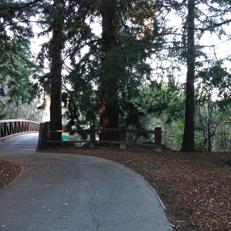
Just south east of the State Plaque, there is a wooden foot bridge. Across the foot bridge is the site where Gaspar de Portolá and his men camped. Under the tall tree (Palo Alto), there is boulder with a private plaque marks the spot.
Afterthoughts
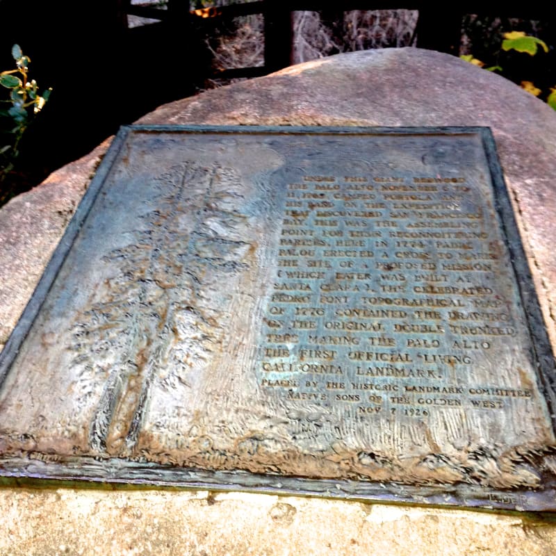
THE SECOND PLAQUE just south of the wooden bridge says: "Under this giant redwood, the Palo Alto, November 6–11, 1769, camped Portola and his band on the expedition that discovered San Francisco Bay. This was the assembling point for their reconnoitering parties. Here in 1774 Padre Palou erected a cross to mark the site of a proposed mission (which later was built at Santa Clara). The celebrated Pedro Font topographical map of 1776 contained the drawing of the original double trunked tree making the Palo Alto the first official living California landmark."
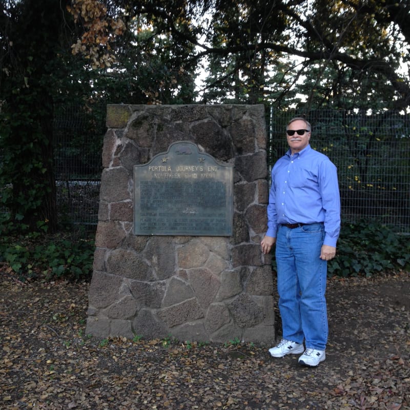
CHL #2 Portolá Journey's End
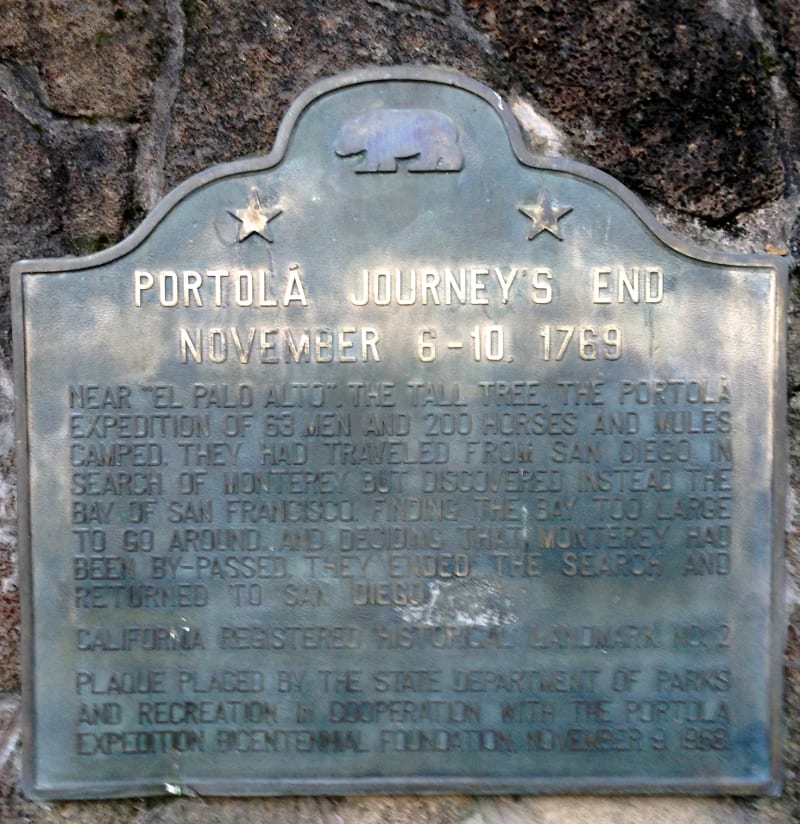
CHL #2 Portolá Journey's End State Plaque
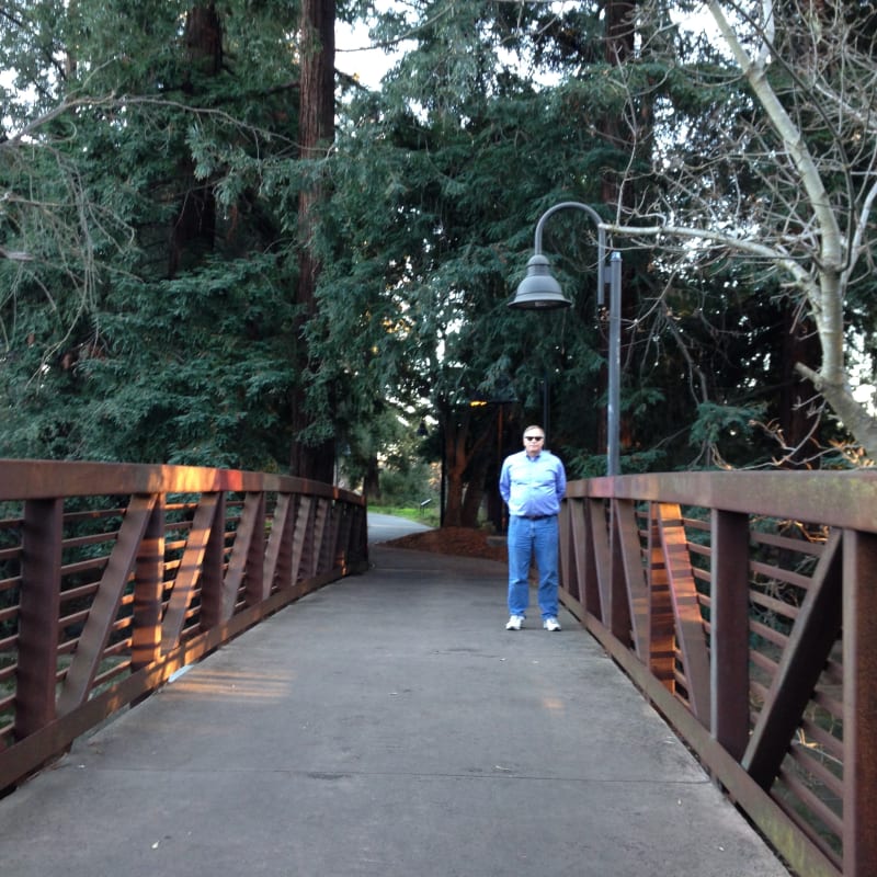
Bridge to CHL #2 - Portolá Camp: November 6-10
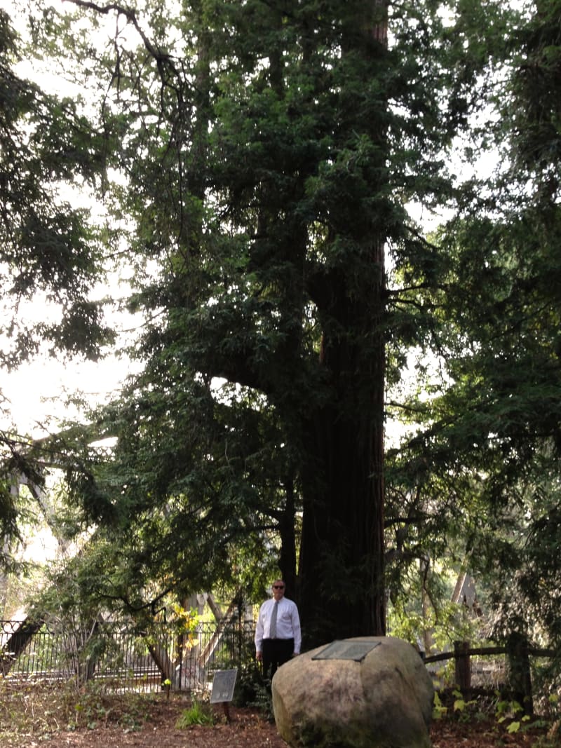
NO. 2 PORTOLÁ JOURNEY'S END - El Palo Alto - The Tall Tree
NO. 2 PORTOLÁ JOURNEY'S END - Palo Alto Plaque
CHL #2 Portolá Camp: November 6-10