Guidebook
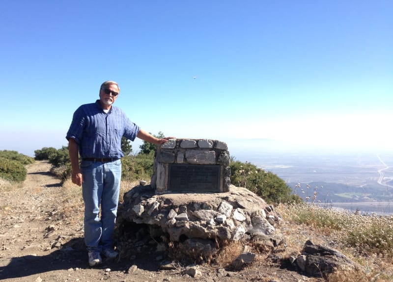
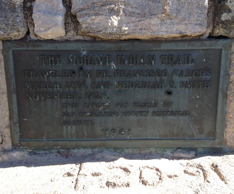
NO. 618 GARCÉS-SMITH MONUMENT - This monument marks an old Indian trail, the Mojave Trail, used by Father Garcés in March 1776 on his trip from Needles to San Gabriel. The same trail was used by Jedediah Smith in 1826 on his first trip through San Bernardino Valley.
Location
The phone number in the guidebook in no longer valid. We called the San Bernardino National Forest Service at San Bernardino National Forest at (909) 382-2600
Open Map
Notes
We approached Monument peak from Crestline. Using our car's GPS, we took Waters Drive to Devil's Canyon Road. Then, GPS then directed us to head 1.2 miles up a fire road to Monument Peak. This was a one lane drive over VERY rocky terrain. Landmark #618 is located where he fire road meets "2 N 49".
Afterthoughts
Bill Beaver at "http://thebillbeaverproject.com/2013/06/16/my-big-bear-birthday/" found the landmark by hiking up "2 N 43". He says. "It was right at the intersection of Roads N49 and N43." ~~~~~~~ in the links below you will find a couple of hiker's blogs sharing their experiences.
NO. 618 GARCÉS-SMITH MONUMENT - Marker
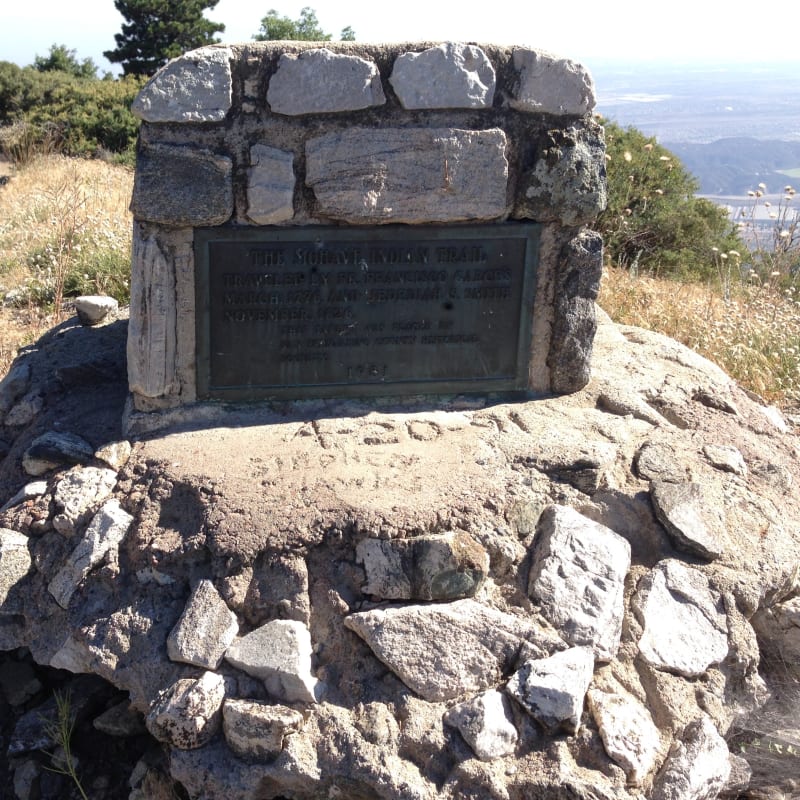
NO. 618 GARCÉS-SMITH MONUMENT
NO. 618 GARCÉS-SMITH MONUMENT - Private Plaque
NO. 618 GARCÉS-SMITH MONUMENT - Monument Peak