Guidebook
NO. 357 INDIAN MILITARY POST, NOMI LACKEE INDIAN RESERVATION - An Indian military post from 1854 to 1866, the Nomi Lackee Indian Reservation controlled 300 to 2,500 militant Indians. U.S. Survey of 1858 showed the reservation to cover 25,139.71 acres. The Indians moved to Round Valley in 1866.
Location
Osborn Road, 3.7 mi N of the intersection of Osborn Rd. and Corning Rd., Flournoy.
Open Map
Notes
From Corning Road, Flournoy, turn north onto Osborn Road. Zig zag north on on Osborn Road for 3.7 mi. You will come to a fork in the road where Osborn splits. In the center of the split you will see a locked gate with an old rusty tin barn beyond the gate. (See picture below.) The plaque is about 200 ft west of the old tin barn.
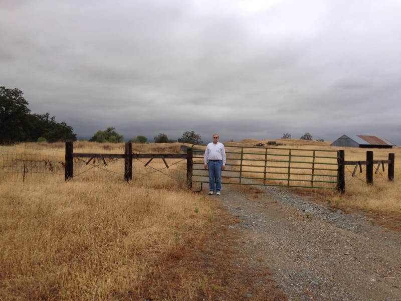
NO. 357 NOMI LACKEE INDIAN RESERVATION - Gates to the property

NO. 357 NOMI LACKEE INDIAN RESERVATION - Up and over the gates

NO. 357 NOMI LACKEE INDIAN RESERVATION - Memorial 200 ft. west of barn.
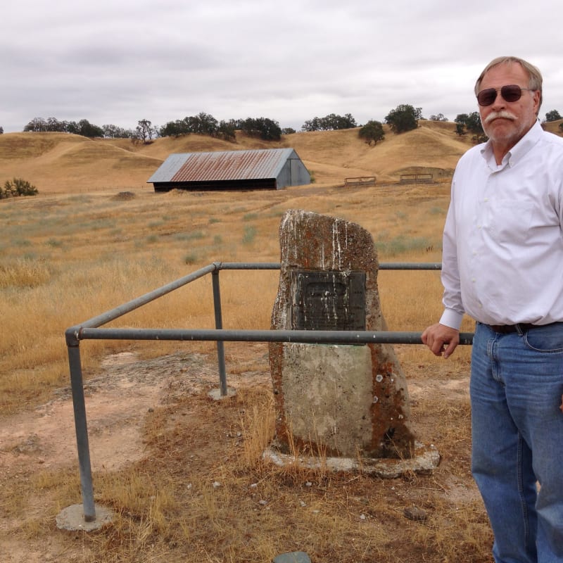
NO. 357 NOMI LACKEE INDIAN RESERVATION - Marker
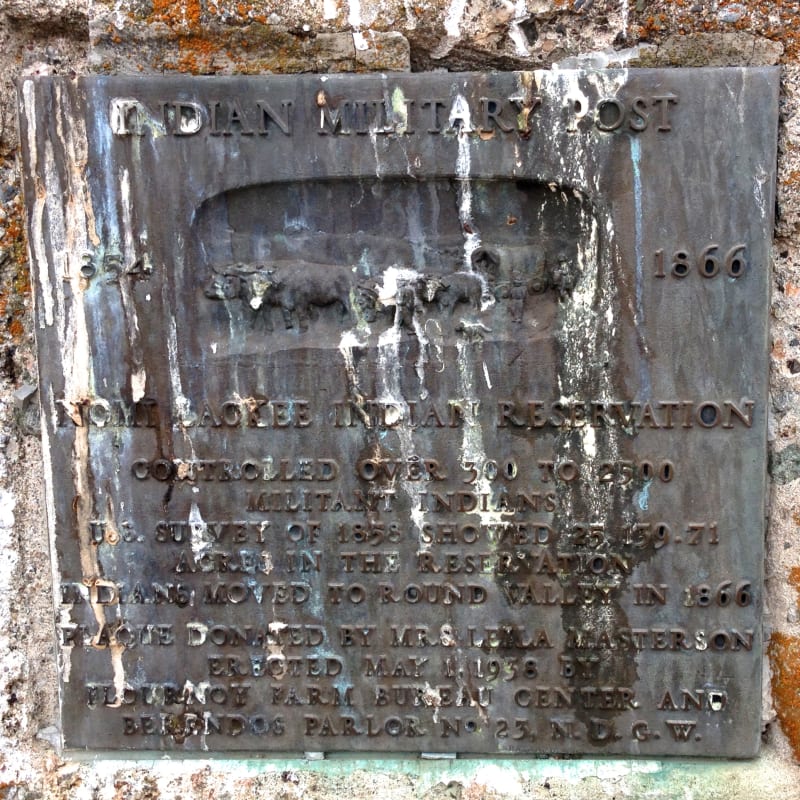
NO. 357 NOMI LACKEE INDIAN RESERVATION - Private Plaque