Guidebook
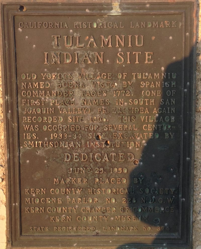
NO. 374 TULAMNIU INDIAN SITE - The old Yokuts village of Tulamniu was named Buena Vista by Spanish Commander Fages in 1772. Fr. Zalvidea again recorded the site in 1806. This village was occupied for several centuries, and in 1933-34 its site was excavated by the Smithsonian Institution.
Location
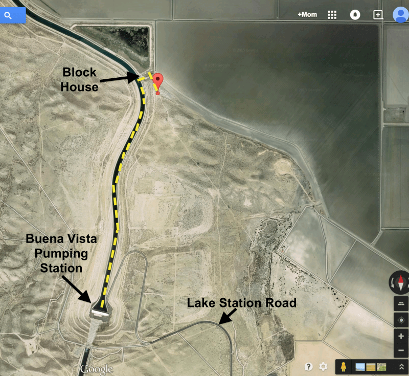
Block House #BV4 North of Buena Vista Pumping Station
Open Map
Notes
This site was tricky. We first tried the roads that were south of the marker, but all roads leading to the aquaduct were gated and locked. Perhaps one could just hike north from the Buena Vista Pumping Station 1.1 mi., then turn east at The Block House #BV4 (see map below). We do not recommend our route as it took us through a farm north of the marker. The roads were rough, narrow and adjacent to irrigation canals.
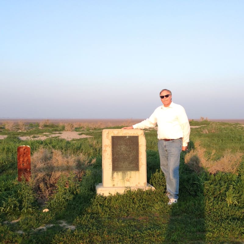
CHL #374 - Tulamniu Indian Site
CHL #374 Tulamniu Indian Site Private Plaque