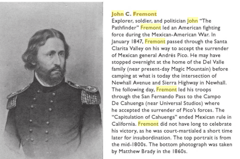
Guidebook
NO. 756 SYCAMORE TREE - In 1846 General John C. Frémont passed this sycamore tree on his way to sign a treaty with General Andrés Pico to secure California for annexation to the United States. The tree has served as a resting place, a polling place, a temporary post office, and an outdoor chapel.
Location
Highway 126 (P.M. 16.7) at Hall Road, 4 Miles East of Santa Paula
Open Map
NO. 756 SYCAMORE TREE - Marker
![NO. 756 SYCAMORE TREE - Marker](https://res.cloudinary.com/hmwsi1uow/image/upload/c_scale,w_800/q_auto/v1452468824/avxg1bwywhlhkyvvhfao.jpg)
NO. 756 SYCAMORE TREE - Marker
![NO. 756 SYCAMORE TREE - Missing Plaque](https://res.cloudinary.com/hmwsi1uow/image/upload/c_scale,w_800/q_auto/v1452468743/agdhsgtzbbpnp7plqx5t.jpg)
NO. 756 SYCAMORE TREE - Missing Plaque
![NO. 756 SYCAMORE TREE - Street Sign](https://res.cloudinary.com/hmwsi1uow/image/upload/c_scale,w_800/q_auto/v1452468776/tdextdvmwgwodwmc16ma.jpg)
NO. 756 SYCAMORE TREE - Street Sign
![NO. 756 SYCAMORE TREE - Street Sign](https://res.cloudinary.com/hmwsi1uow/image/upload/c_scale,w_800/q_auto/v1452468697/ijrryahwihifotyyu1m4.jpg)
NO. 756 SYCAMORE TREE - Street Sign
![See Page 16 in the link above.](https://res.cloudinary.com/hmwsi1uow/image/upload/c_scale,w_800/q_auto/v1461275647/sx040p3i6eepbkgiuphr.png)
See Page 16 in the link above.