Guidebook
NO. 919 ST. FRANCIS DAM DISASTER SITE - The 185-foot concrete St. Francis Dam, part of the Los Angeles aqueduct system, stood a mile and a half north of this spot. On March 12, 1928, just before midnight, it collapsed and sent over twelve billion gallons of water roaring down the valley of the Santa Clara River. Over 450 lives were lost in this, one of California's greatest disasters.
Location
San Francisquito Power Plant No. 2, 32300 N San Francisquito Canyon Rd, 9.2 mi N of Saugus
Open Map
Notes
Our first visit was in November 2014, but we just visited the plaque. Every March, on the weekend near the anniversary of the dam collapse, the Santa Clarita Valley Historical Society gives a presentation and leads a hike to the original dam site.
Afterthoughts
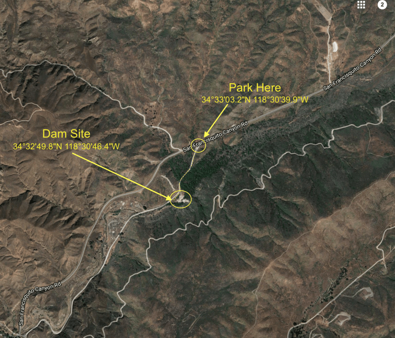
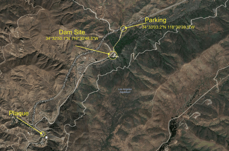
The dam site is an easy stroll from the parking along side San Francisquito Canyon Road. -- Coordinates for the dam: 34°32'49.9"N 118°30'46.5"W. -- Coordinates for parking: 34°33'03.6"N 118°30'39.8"W
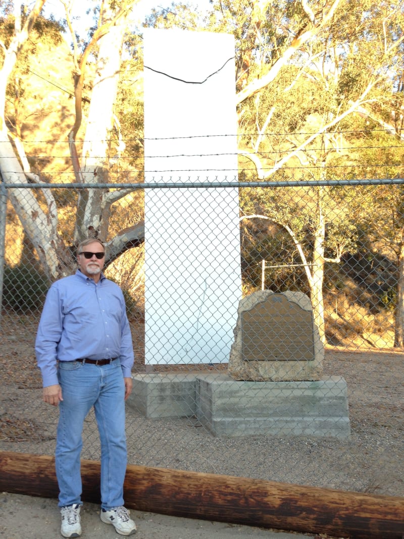
NO. 919 ST. FRANCIS DAM DISASTER SITE - Marker
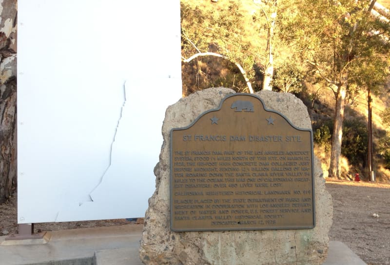
NO. 919 ST. FRANCIS DAM DISASTER SITE - State Plaque
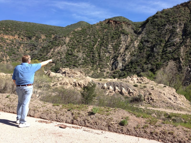
NO. 919 ST. FRANCIS DAM DISASTER SITE - East wall anchored to landslide
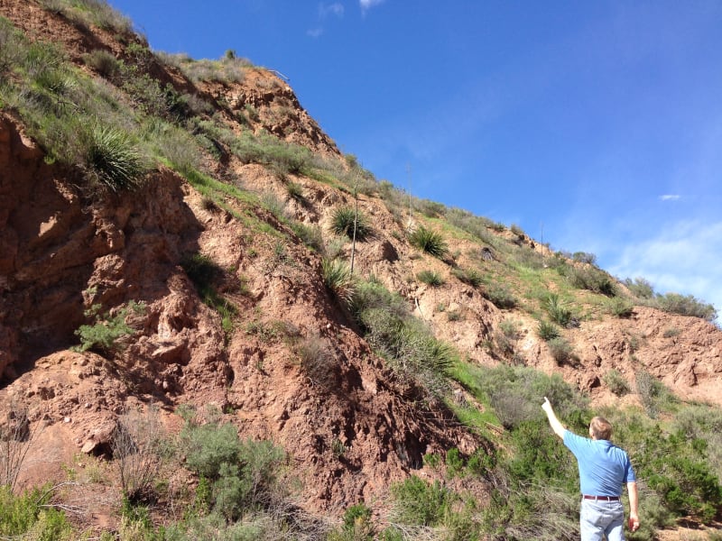
NO. 919 ST. FRANCIS DAM DISASTER SITE - West wall anchored to schist
NO. 919 ST. FRANCIS DAM DISASTER SITE - Remains of the dam
NO. 919 ST. FRANCIS DAM DISASTER SITE - Map to site of the dam