Guidebook
NO. 648 FOUNTAIN SPRINGS - The settlement of Fountain Springs was established before 1855, 1-1/2 miles northwest of this point, at the junction of the Stockton-Los Angeles Road and the road to the Kern River gold mines. From 1858 to 1861, Fountain Springs was a station on the Butterfield Overland Mail route.
Location
Highway M109 and County Road J22
Open Map
CHL #648 - Fountain Springs Marker

CHL #648 - Fountain Springs Marker

NO. 648 FOUNTAIN SPRINGS
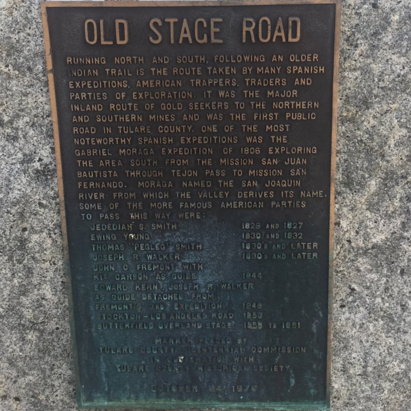
NO. 648 FOUNTAIN SPRINGS Old Stage Road

CHL #648 Fountain Springs "El Cojo" Marker

NO. 648 FOUNTAIN SPRINGS "El Cojo"

CHL #648 Fountain Springs